 The best for the end – after having seen all Australian urban rail systems, I daresay that Perth boasts the best of all. Although there is always something to improve and criticise, I think that other cities, notably Adelaide, should have a look at the Perth rail system to see what can be achieved in an acceptable period of time.
 Until around 1990, the Perth rail system looked a bit like the current Adelaide system, old-fashioned lines with diesel-powered trains. Then the existing three lines that radiated from Perth were electrified, and eventually two completely new lines were built, the ridership of which exceeded expectations by far.
 The present system consists in fact of two cross-city lines plus one radial line with two branches, although officially the network is shown with five radial lines. In normal operation however, the Joondalup and Mandurah Lines, as well as the Fremantle and Midland Lines, form a single line, although there is a buffer of a few minutes built into the timetable at Perth station. Unfortunately this way of presenting the lines can be rather confusing especially for occasional travellers who want to continue their journey beyond the city centre on the same line and find out only once they arrive at Perth station that the train they are on actually continues to their destination anyway. On the Joondalup/Mandurah Line, the lines are shown as overlapping between Perth Underground and Esplanade and announcements inside the train in fact tell people that the train goes to Clarkson or Mandurah, respectively, but I have not observed anything like that on the Fremantle/Midland Line. So my proposal is to rename these lines officially as “Fremantle & Midland Line” and “Joondalup & Mandurah Line”. The fifth line is shown as Armadale/Thornlie Line, with the Thornlie Line operating as 'Local' on the share section (except Beckenham, which is served by Armadale trains). All lines are identified by colours, which are also used on station signs.
What makes me classify the Perth rail system as the best in Australia are the following factors:
its travel speed, both real (on the Mandurah Line trains reach a maximum speed of 130 km/h!) and perceived (short station dwelling time)
short intervals with a train every 15 minutes at all stations during off-peak daytime hours and extra trains during peak
stopping patterns (mostly for peak-hour service) are well illustrated on the platforms and in printed timetables, and the train's destination display also includes this as a letter code
pleasant rolling stock offering a very smooth ride
multi-access stations, mostly with entrances at either end of the platform to avoid long detours
full accessibility via lifts or ramps
operationally three clearly segregated lines
fully integrated fare system
 To increase capacity on the older lines, the A-series rolling stock was refurbished with longitudinal seating throughout, which gives them a rather metro-like feel. Due to limited platform lengths, only 4-car trains can operate on these lines, whereas on the new north-south route the newer and faster B-series trains are used which run either as 3-car or as 6-car compounds.
Most stations on the older lines look pretty simple, which makes the system appear more like a high-floor light rail system. On these lines there a several level crossings, although fewer than for example in Melbourne. The Joondalup & Mandurah Line, however, is completely grade-separated and all stations boast a substantial structure, although there seems to be a theme running through them (the use of corrugated sheet-metal, traditionally used for construction in the region), which makes them look a bit shabby especially at the stations located in the median of a freeway (both the Joondalup and Mandurah Line were built largely in the median of a freeway), but generally they offer a pleasant atmosphere.
While the north-south route is completely separate from the other lines (there are track links west of Perth station), even the Armadale/Thornlie Line is separate from the Fremantle & Midland Line, with the section between Perth station and Claisebrook (also the location of the older depot) is four-track. On the Midland branch, a few passenger trains can be seen, the daily Prospector to/from Kalgoorlie and the twice-weekly Indian Pacific to/from Sydney and Adelaide. As these trains run on standard gauge and the Transperth system is narrow gauge (1067 mm), the section between the long-distance terminal at East Perth and Midland has 3-rail tracks. Freight traffic, however, is diverted towards Fremantle on a southern bypass route and only interferes with Transperth services on the bridge across the Swan River in Fremantle.
 The biggest criticism I would make about the Perth rail system is the excessive station distance on the new north-south line, both on the slightly older Joondalup Line and on the recent Mandurah Line. With many stations located in the median of a freeway and huge car parks adjacent to them, there is hardly anyone who lives within an acceptable walking distance. Except for Joondalup station, which is next to a large shopping mall, all stations are in the middle of nowhere, although most have good bus connections. Even the Mandurah terminus is a long way from what is Mandurah “city” centre (nothing much of a centre there really...). Rockingham station was relocated rather a long way from the town centre to save costs, while instead the line was built on a more direct route towards the Perth city centre (initially it was planned to run from Thornlie towards Cockburn along the freight line corridor. So what you gain by a fast train you may lose again by a connecting bus ride to take you home.
The rail system is publicly operated by Transperth and fully integrated with bus services (and one ferry line). The metropolitan area is divided into 9 circular fare zones, which extend more than 100 km north-south. A dayrider ticket is available at AUD 9.00 for travel after 9:00 am, and valid in all zones. Similar to Brisbane, most people travel with a Smartrider smartcard, but single tickets and day tickets are sold as paper tickets; there are ticket barriers at busy stations, but to check paper tickets at least one gate needs to be manned. Transit officers (and there are more of them visible in Perth than anywhere else in Australia!) carry out tickets inspections on trains, too.
Buses, like everywhere in Australia, are abundant and hard to understand as once again no maps are available, just a printed timetable for each line. Quite useful for visitors, but also busy with locals, are the CAT buses, these are three free bus routes in the central area of Perth, plus one in Fremantle. Surprisingly, there are maps with proper stop information for these lines, even next-bus indicators at stops, whereas for regular bus routes, often a one meter high post with only the bus stop number seems sufficient! So, in this field, Perth unfortunately is not much better than any other Australian city.
All in all, Perth has proved that if you provide a good rail service, it will be successful, but no doubt it has required a high investment, first to electrify the old system and then double the network's length by building two state-of-the-art routes.

 The original stretch was completely upgraded before new trams were introduced in around 2005 (the same Bombardier Flexity Classic model as used in Frankfurt/Main – S class there). The new sections are technically well-built, a reserved lane is available throughout, but operationally I would classify it as a complete failure. The trams spend almost more time waiting at traffic lights than actually travelling through the city, this makes the idea of a reserved lane almost obsolete. The concept of priority at traffic light for trams (and buses) is something unheard of, so each tram has to wait a full traffic light cycle to continue its journey, and traffic lights generally change very slowly all over Australia compared to most European cities (Vienna is a bit Australian in this). Between Railway Station and City West the planners were obviously forced by politicians to reduce the line for some 100 m to single-track, just to allow a separate lane for cars turning right into the Convention Centre parking! Outbound trams are forced to manouvre themselves over two sets of points which has to be done at some 5 km/h (we all know that Citadis trams don't like points at all....). This is a clear case that the reintroduction of trams is handled very half-heartedly by some who still believe that the car is king in the city!
 For the latest extension Adelaide acquired some of Madrid's superfluous metro ligero Citadis trams which are quite popular here. Except for the adverts on most vehicles, they basically maintain the Madrid livery with the typical red nose.
 The Adelaide suburban train network is some 20-30 years behind those in other Australian cities, but like the similar Auckland system, this is finally changing. At present mostly two-car diesel powered trains serve 6 branches all radiating from the terminal station located at the northern fringe of the city centre. The older Jumbo trains are proper DMUs, and they are loud and take a while to accelerate, whereas the newer stock is diesel-electric, and despite the noise they make they are almost like electric trains when it comes to acceleration. In fact, these are now being refurbished and most of them will be converted to full EMUs by 2013. In preparation for electrification, the Noarlunga Line is closed south of Oaklands station while the entire track is being renewed. As has already been done on the Outer Harbor Line and part of the Gawler Line, new concrete sleepers are being laid, which will allow the future re-gauging of the entire system from broad gauge (1600 mm) to standard gauge. New trains have been ordered from Bombardier, and these will also be ready for conversion to standard gauge at a later date.
 The system has a strong suburban character, with busy peak-hour trains and quite empty trains during off-peak. The overall impression is that it is a slow system, but with one-person operation dwelling time at stations is short. Trains from the southern branches run around the western edge of the city before reaching the terminus, so in a next step a tunnel under King William Street would certainly be recommendable to create a through north-south axis penetrating the city centre directly (apparently someone else had proposed this in the 1930s). Passengers from the southern lines are not able to change to the tram line, despite Goodwood rail station being located right below the tram bridge across the tracks. So someone working in the Victoria Square area, for example, needs to take a long detour or take a long walk from Goodwood to the nearest tram stop. A proper network integration would certainly include a transfer station at this point.
 Most railway stations have only very basic equipment, generally a busstop-like shelter and a busstop-type timetable post. Ticket-vending machines are located inside the trains. Some stations have been rebuilt in recent years, but while Oaklands and Hallett Cove are quite pleasant (although a simple concrete floor isn't really the most elegant style), I would vote the elevated Port Adelaide station the ugliest new station built in recent years worldwide. It sits on a beautiful historic viaduct, but the concrete/sheet-metal station will hopefully attract some graffiti soon to embellish it....:). Mawson Interchange has a similar style, but the lack of visual appeal is at least compensated by a cross-platform interchange between buses and inbound trains. As the system has a rather light-rail appearance anyway, with short trains and closely spaced stations, it might have been a better idea to completely convert it to light rail, maybe with some RegioCitadis-type rolling stock which support higher speeds on railway lines.
 What makes Adelaide unique in the worldwide transport scene, however, is its O-Bahn: this system was developed in the German city of Essen, and then copied nowhere else but in Adelaide. This type of busway consists of concrete beams with lateral guideways, so buses can run at a speed of up to 100 km/h over the 12 km grade-separated busway, which only includes two intermediate stations, so the perceived travel speed is indeed very high. The O-Bahn is used by numerous bus lines, some leaving the busway at the Paradise Interchange or continuing beyond the “terminus” at Tea Tree Plaza. The busway was built through a linear park along the Torrens River, and its visual impact is enormous, and in fact it is impossible to cross the “tracks”, unless there is a bridge or underpass. The major problem seems to be the fact that the O-Bahn starts some 2 km from the city centre, so a solution is being sought for the route along Hackney Road where the fast buses are now caught in traffic jams during peak hours. So while I'm normally not advocating bus-based transport, I have to admit that the O-Bahn is by far the fastest type of transport in Adelaide (and the ride at top speed is still pleasant!) and that it will be hard to convince people that a conversion to light rail might be a better option. The way the Glenelg tram is operated now it is hard to imagine that any kind of train would be able to travel at 100 km/h – and the buses take most passengers directly to their destination.
 There are two stations that are sort of underground, Pyrmont Bay and Star City, but both are not too pleasant, more like tram stops in the basement of a building. John Street Square stop lies in a deep cutting and like the neighbouring Fish Market is accessible via a lift or steep stairs. Most other stops are accessible via ramps, with passengers crossing the tracks. There are no level crossings for motorised traffic west of the point where the old freight line begins near the Paddy's Market stop. The line is planned to be extended along a still used freight line to Dulwich Hill, so there will be mixed service. There has been talk about extending it on the city end down to Circular Quay, but unless this is combined with a drastic reduction of buses running along George Street or Elizabeth Street, there is not much point in doing so. Even before the Dulwich extension, the existing line needs to be integrated into the overall transport network, then it can become the backbone for good transport in the inner western suburbs.
  The tram is operated by Veolia as “Metro” light rail, and this company also runs the Sydney Monorail, which is a mere tourist attraction (and couldn't cope with normal passengers anyway in case it was integrated). The fact that a combined day ticket is available for tram and monorail and that both are shown on a joint “metro” map makes you think that the tram is also rather a tourist attraction.
 This is one of the factors why I would say that in the often mentioned rivalry between Australia's two major cities, Melbourne and Sydney, in the field of urban transport, Melbourne beats Sydney by far. The Melbourne system appears much more modern and fast, despite the numerous level crossings, which in Sydney are rather the exception on some outer stretches. Although CityRail is a large system and one of the most complex railway systems I have seen, it leaves many areas of the metropolitan area without coverage, notably, the entire northwest, the northeast, as well as many parts of the southeast (which were initially meant to be served by several stations beyond Bondi Junction on the Eastern Suburbs Line). The northwestern area has been repeatedly on the agenda, last only a couple of years ago with the proposal of the Euro-style “North West Metro”, which shortly after was curtailed to become a “CBD Metro” only (which has also been forgotten after a few months). A rail line to the northeastern suburbs was only seriously considered when the Harbour Bridge was built in the 1930s, which had provisions for a second pair of suburban tracks on the eastern side, which were then used by trams for several years (and since by cars, of course...).
 So while Melbourne's overall coverage is better, the suburban rail system there is complemented by a huge network of trams, a type of transport almost absent in Sydney. Instead one relies on the hundreds of bus routes, which like in most places are difficult to understand and many finish service at ridiculous times in the early evening. Even the newly introduced Metrobuses don't even run until midnight. So Iwas glad that my accommodation was within walking distance of a rail station. Bus maps for the Sydney Buses exist but are hard to find, and almost all date from 2009 and don't include the new Metrobuses. Most bus stops have only minimal information, although printed timetables are available and even have a route map for that line, which is quite useful when you are unfamiliar with the area. There are no annoucements within the buses. So once again I have to say that the bus system is far below from what one might expect from a world-class system.
 Back to CityRail, I generally don't like double-deck carriages a lot, as they give you a very bad view of who is on the train, and with only two doors on each side, it also takes much longer for passengers to get off or board. Also, Sydneysiders seem to be a bit like Stockholmers, as they only get ready to get off once the train has come to a stop, instead of preparíng themselves before. This may be a result of the fact that they know that the train will be standing in the station for a while anyway, so why hurry? All trains have 3+2 perpendicular seating, but I don't like the 3-seat side at all. Mostly noone wants to sit in the middle seat, and it is generally empty or taken by a bag. Unfortunately I also observed that unless you claim this seat, it will never be offered to you by the bag's owner. It is also quite troublesome to get out of the window seat if both or just one of the other two seats are occupied, as these people have to stand up and actually get out into the narrow aisle to let you out. On the other hand, noone wants to stand in this narrow aisle neither upstairs nor downstairs. So, I think that Melbourne's choice for future 2+2 seating is generally better. Sydney has, however, one feature hardly found anywhere nowadays and quite popular (I only recall this type of seats from old suburban trains in Spain in the 1980s), and that's the possibility to flip the back support of all seats so that you can always sit in the direction of travel. Apparently when some Tangara trains came without this option, passengers claimed that and got it again on the latest Millennium trains.
 Stations are generally in a good shape, many of the suburban stations preserve a small historic building on the platform, though often hidden behind modern canopies. Like in other Australian cities, most stations have acceptable toilets. In recent years, many stations were retrofitted with lifts to provide full accessibility (the door height of the trains matches more or less the platform, and for wheelchair users, the train guard can unfold a manual ramp located in a cupboard on each platform).
  style but still nice); to the badly designed 1990s stations on the AirportLink (narrow platforms, illogical accesses, and dim lighting!); to the newest deep-level stations between Chatswood and Epping, which boast spacious and pleasant caverns (probably my favourite Sydney station being Epping underground, with its twin tube platforms, the most metro-like station of all...). The station at Olympic Park opened for the 2000 Olympics is a covered three-track station in a trench with a very European design. The recently rebuilt Chatswood station is also a typical station you could find anywhere in Europe nowadays, with stainless steel, glass and concrete as the main elements, but with a few orange finishings it has a pleasant individual touch to it.
 The biggest advantage is without doubt the one-seat ride from the CBD to your home, at a speed which is probably higher than any other possible transport, at least as soon as the bus is on the dedicated busway. But to achieve this exclusive, almost taxi-like service, you need to provide an extremely large amount of different bus routes to reach every corner of the urban and suburban sprawl, which results in a network layout which is impossible to illustrate (at the Transit Information Centre they admitted that they cannot print a bus map because there are so many lines – anyway, they don't even print a map for the central area or for individual suburbs either....). As the enormous flux from the suburbs into the CBD and back home again occurs only during peak hours, I observed MANY buses leaving the central area almost empty during daytime hours. Of course, you cannot have 500 bus routes running every 10 minutes during the day, but if the frequency is not good enough, no occasional rider bothers to wait for that bus. So while regular CBD commuters will know which bus they take and from where, the “system” is useless for occasional riders (not to talk about visitors not familiar with many place names). Even on the busways it is actually not really clear where all these buses go to, as there are so many different lines passing through that even the experienced traveller loses control, inbound it is always easier as most go to the CBD. I don't know about costs, but I cannot really believe that paying the salary of all the necessary bus drivers is not a strong argument against this sort of transportation. In general, the bus fleet appeared more modern than for example in Auckland, and some buses were even powered by natural gas. Still exhaust fumes extraction from the tunnels must also be an important cost factor.
 But as I said in the introduction, Brisbane also has quite a nice suburban rail system which works pretty well, with most routes being served every 30 minutes (also on weekends!), with some sections carrying two lines. Many sections in the central area have three or four tracks, so for the time being there is no real bottleneck, especially as regional rail traffic that shares some sections is not too important. The Airport to Gold Coast Line is somewhat different from the other typical suburban rail lines: the partly single-track airport access was built with private capital and therefore has a special fare, from Eagle Junction south the trains can be used with normal tickets (see below). South of Park Road station, the Gold Coast trains run express to Beenleigh (some stop at a few intermediate stations, too), from where the line has a more regional than suburban character anyway. The Queensland Rail suburban system used to be branded CityTrain (and this is still shown on some trains), but for some unknown reason this name is no longer used.
 The fleet includes three different generations, the oldest still being the most strongly represented, but having been refurbished, they offer almost the same comfort as the newest series, all with air-conditioning and acoustic station announcements, the new ones also with visual announcements. Operation and dispatching appears a bit more old-fashioned than in Melbourne, there is a second man (I think I have only seen male drivers and conductors...) always in the cabin of the second trainset (most trains are operated as two 3-car sets), and there is an “invitation” saying “Doors closing, stand clear!” They also announce the next station and which side the platform is on. The floor height only matches the platform height in a few stations, sometimes when there is a slight curve, it can get quite high! The conductor has a manual ramp for wheelchair access.
 The stations are generally in a good shape, some have a 1930s appearance, while others have been rebuilt completely, and now feature lifts and footbridges. As in Melbourne, all stations have generally usable toilets. Many stations still have older Queensland Rail signs, strongly faded and sometimes impossible to read the name. Others have been replaced with a new design, not too appealing in my opinion, but the newest ones have a strong orange stamp, for TransLink, the Transportation Authority of Southeast Queensland. So, large orange signs now at least hint car drivers at existing stations, but unlike in Melbourne, the colour does not reveal the mode, thus a busway station looks the same as a rail station. A feature worth copying in other places is the automatic acoustic pre-annoucement of the next train 2 minutes before its arrival, like “The next train on platform 2 is a City and Ferny Grove service and will arrive in approx. 2 minutes” or similar.
 When I went to Gold Coast, I got off at Nerang and was picked up by a local fan, the typical situation when you forget to touch out! And I forgot. I wasn't sure how I could solve this situation, but when the guy dropped me at Varsity Lakes (the southernmost station of the system), the ticket office lady told me, I should simply touch out first at the machine inside the station (this one has proper gates, though open....), and then touch on again to return to Brisbane. This means that I “finished” my journey three hours after getting off the train and it still accepted it as valid. Anyway, as I wrote for Melbourne, I prefer simple tickets which for a set price say where you can go, and with the option of unlimited rides. The Brisbane system doesn't help to get more people out of their cars – the whole philosophy behind “day/weekly/monthly passes” is that you are more likely to use public transport if you already have a ticket (at a fair price!), and the feeling that you made the most of it. Having to pay a new fare for each trip makes you always think twice whether you should actually do it.
 When I left my accomodation near South Yarra station for the first time last week to explore the city's urban rail system, I thought, the area looks very much like London, but with a Viennese tram system, and indeed there are several similarities, most of all the density of the network, with trams through every second street, a quite frequent service, a mixture of old and new vehicles, etc.
  The Melbourne tram system, certainly a paradise for any tram fan, has everything a tram system can have. Vintage tram vehicles not only operate on the FREE city circle line introduced primarily for tourists but also popular with locals as it is free (though slow and often packed! - labelled line 35), but they also run regularly on line 78/79 through the busy Chapel Street in South Yarra and Prahran, and line 30 (which is a reinforcement service along LaTrobe Street). Besides these, there are four different types of vehicles, two older high-floor trams and two standard low-floor trams well familiar to Europeans, the Siemens Combino and the Alstom Citadis (with some newer ones first leased from Mulhouse but now permanently staying down under). The Combino trams surprised me for the small amount of seats they offer, I'll have to check at home whether the European versions have the same seating arrangement. The other weak point is that they are rather loud, probably partly due to the loose wheels they have in the middle, but they are always loud rattling along the streets, both when you're inside and outside. The Citadis seem to be slightly more quiet and offer much better seating, so in this case I would opt for the French solution. But anyway, I was told that Bombardier trams have been ordered as the next generation.
 As far as alignment is concerned, the network also includes everything one might think of, from street-running in mixed traffic with cars, to marked-off lanes, to reserved right of way, to railway alignments taken over from former suburban railway lines (line 96 to St Kilda, and 109 to Port Melbourne). Sometimes boarding is from street level (car drivers generally stop, and sometimes I observed tram drivers telling them off if they didn't or even writing down their number). When the doors open, a sign like that at pedestrian crossings folds out and trams have flashing lights on. Generally my impression was that traffic among cars runs smoothly and that it is not too dangerous, as obviously everybody driving around here has grown up with trams, so it's not a strange element for them in road traffic. Sometimes there is a narrow boarding area in the middle of the street protected by a fence, but it's very narrow, so one doesn't really feel comfortable waiting in that space. In recent years many stops have been completely rebuilt and are now proper “platform stops” and also shown as such on line panels. These mostly have electronic next-tram indicators. Generally, all stops have a proper stop sign (in green, of course, like everything related to the trams), and mostly there is also a timetable displayed, but sometimes I found it missing. As is normal with street-running systems, the punctuality is somewhat at random, sometimes I was surprised how much on time a tram arrived, and sometimes you wait for a while and then you get two or even three vehicles arriving at the same time.
  The termini are mostly very basic, and generally one single-track in the middle of the road. This may be quite a problem during peak service, when the stop is still occupied by the previous tram, or the stop has to serve even two different lines. At some termini, there is a set-down point still in the double-track section, so at least passengers can get off instead of waiting to enter the terminus proper. I was surprised that several stub termini located perpendicularly to another passing tram line do not have a track connection to that line, which is common in other places to facilitate diversions in case of disruptions.
 Swanston Street in the downtown area is probably the busiest tram route in the world (maybe Karlsruhe's Kaiserstraße is similarly packed and therefore now gets a tunnel underneath), with a total of 9! lines running through there – and 7 of these terminate at Melbourne University, which has quite a peculiar layout to cope with so many reversing trams (all bidirectional and single units): there are three reversing sidings between the running tracks, located one behind the other; if I have observed it correctly, an arriving tram goes into the next available siding, but obviously cannot remain there long either. Despite this heavy traffic on Swanston Street, the system works fine, but generally there are far too many stops, basically on every street corner, and sometimes in between, too. Being so many, the maps don't show all the stops, not even the line panels do. So for better orientation, the stops are numbered. But the stop signs also show the name of the stop (basically the crossing street). The numbering system is not completely useful, although it helps, of course, but with the construction of platform stops, the total number has been reduced on some sections, but the numbers remain. Also, the number of the stop can only refer to one line, and when there are two or more lines running along the same stretch, the numbers on one line may get out of order. Usually the numbers run from the city centre to the suburbs. The stops on the lines that were extended into the Docklands area had to be given negative numbers, well, in reality its D1, D2, etc.
 The trams share the fare system of the Metro and bus system, but recently it was decided that all tram routes can be used with a zone 1 ticket to simplify things. On outer stretches (part of the overlapping zones) the cheaper zone 2 ticket can also be used. Officially, and I was told so today by a ticket inspector, everybody has to validate their Metcard each time they board, but nobody does it as it doesn't really make sense, but those using a Myki smartcard have to touch on and off, which takes quite a bit more time, so it seems almost unimaginable that the new system will one day work as the only ticket, as it would delay boarding and alighting enormously. And they will still need ticket inspectors (and inspecting Myki tickets also takes much longer as they have to introduce it into their control device!). I heard from some people that the extremely costly introduction of the smartcard system was more of a political decision than an economic one, especially as the distribution of the revenue seems to be working fine as it is now.
 While the general appearance of the stations is quite good, all clean and tidy, and most with usable toilets, I was often annoyed by the bad accessibility. Probably thought to create a properly separated paid area, most platforms are enclosed by fences, so one often has to walk a long way to the actual entrance when an opening at the other end of the platform would be easy to make and save passengers a lot of time. Therefore I didn't understand either why they don't put proper ticket gates, if the access is channelled through a small slot anyway. At many stations with side platforms, the two platforms are not really connected, but one has to walk to a nearby level crossing to get to the other side (well, I have to admit, that being used to right-hand operation, I sometimes mistook the platform until I realised....).
 There are basically three different types of trains, although some of the older Hitachi trains are still in service during peak, but I only spotted a few and never got a chance to actually ride them. The second-oldest are probably the largest number, those are the refurbished Comeng trains. They are quite pleasant, except for their peculiar door handles. Unlike on the newer trains, which have a normal button to open the doors, these have a knob, and you have to manually slide the doors open, which can be quite hard, especially if you carry things in your hands.
 The design of the three underground stations is quite European, in fact they could be S-Bahn stations in German cities like Frankfurt, Stuttgart or Munich or even Hamburg, which were built at the same time. There is another covered station at Box Hill (with a shopping mall on top), but this is very basic and not really appealing. Many of the surface stations preserve a nice old station building.
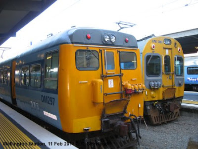 The JVL, which is actually the original route of the North Island Trunk Line towards Auckland, is a steep single track line with various tunnels and passing loops. It is basically separated from the other lines from Wellington Station, although the tracks it normally uses are linked to the other tracks there. This line has recently been upgraded in preparation for the new Matangi trains about to enter service; unfortunately I only spotted one of them on a test run. Meanwhile, this line is operated with EMUs from the 1950s. It is a quite picturesque line as it winds its way up the mountain and provides some nice views of the bay.
 The PPL will be extended further north on 20 February 2011 from Paraparaumu to Waikanae and will change its name to the Kapiti Line (named after the region it serves), although the new timetable still has the “PPL” abbreviation. For the extension of the suburban service the line was doubled and electrified, and a new, though simple station built at Waikanae. The PPL is mostly double-track, although there is a single-track section with five tunnels along the coast between Muri and Paekakariki. There are two longer tunnels after the PPL diverges from the HVL, which were built in the 1930s to create a more direct and less steep route for the mainline to Auckland. The PPL route is also served by one daily passenger train to and from Auckland, “the Overlander” (12 hours!), as well as the “Capital Connection” a daily commuter train to/from Palmerston North.
 Wellington is not only NZ's leader in suburban rail, but has also the most environment-friendly bus system, as it boasts quite a large trolleybus network, apparently the only trolleybus system worldwide that operates on the left side. Unfortunately I didn't get a chance to explore it properly – simply because the trolleybuses remain in the depot on weekends for some strange reasons. While some lines are then operated with diesel buses, others don't operate at all. Still, the city's main transit corridor is used by numerous diesel buses also during the week, which often form clusters which reduces their travel speed through downtown.
 Last but not least, the Wellington Cable Car deserves a mention, too, as this is authentic urban rail. It is also a major tourist attraction as visitors can enjoy a great view from the top and start their downhill walk through the Botanical Gardens, but it is also used by many locals to climb up the steep mountain from Lambton Quay, the city's major shopping street. It is called a “cable car” as it was indeed operated in the early days like the San Francisco cable trams, but it was rebuilt into a normal Swiss-type funicular in the 1970s.
 Christchurch, however, has a heritage tram line, which runs in a circle around downtown on a new route opened in 1995. At present this service is being extended to the southern parts of the city centre and the Polytech campus. As of now, it is only a tourist attraction, with no single tickets available for spontanous short trips; a 2-day ticket, which allows unlimited hop-on hop-off costs 17 NZD (some 9 €). Locals can, however, buy an annual pass to use the tram. In any case, walking is in most cases faster than taking one of the three trams which run daily every 8 minutes. With the new extension and further proposals, the basis is being laid for what may one day become a modern light rail system.
 The two lines running south from the city centre take two different routes as they leave Britomart, but further south rejoin and most trains continue to Papakura. Only a few trains continue even further south on the main line to Wellington to terminate at Pukekohe. This network layout has the curious effect that actually the headway on the outer section, with trains about every 15 minutes, is better than on some inner sections, notably the Eastern Line via Sylvia Park. The stations south of Newmarket, however, are now also served by the Onehunga Line, a branch re-opened in 2010. The Western Line runs every 15-30 minutes, with every other train terminating at Swanson. This line used to be mostly single-track, but has been doubled in recent years all the way until just past Swanson. At the same time, all stations have been modernised or completed rebuilt, the one suffering the most changes being New Lynn, which was put into a trench to eliminate an important level crossing. Now only a few level crossings remain, and at some stations, also passengers have to cross the tracks. Provisions have also been made for electrification, and along some sections masts can already be seen along the tracks. The Southern and Eastern Lines, which have been double-track for a long time, have an older appearance, but several of the busier stations have already been modernised recently. Infrastructure work for electrification has also started here. Another major work completed in this upgrading process is the new station at Newmarket, an important shopping area, and Auckland's second „downtown“. To allow trains from the Western Line to change direction here, the station now has three tracks, but in the future it will also be possible to run direct trains from Grafton towards Britomart as the junction north of Newcastle is now a full triangle.
 At present the service is provided with either diesel multiple units or push-pull trains with diesel locomotives (which look very much like shunting locos to me). The latter are much more pleasant as at least the noise inside the carriages is acceptable, whereas the DMUs are horribly loud. Both types cannot compete with electrically powered trains when it comes to acceleration, not to mention the exhaust fumes they deliver when leaving a station. Therefore it was high time for Auckland to go for full electrification! Let's hope that the new electric trains were designed to match the platform height, as the present rolling stock requires a high step up to climb into the vehicles.
 The re-opening of the Onehunga Line must have been rather a political decision than part of an overall effort to create a rapid transit system. It was probably cheap to do, as the track was already there, but the line is only single-track and very slow, with numerous level crossings on its short route. It certainly served some politicians to say, hey, we did something. It has been proposed to extend the line to the airport, but this would then really give a rather embarrassing image of the city if tourist had to take this „airport express“ into the city. It would probably take as long as the current airport bus.